Guatemala population. Where is Guatemala located on the world map, its attractions
Authors: N. S. Ivanov (General Information, Population, Economy, Mass Media), N. V. Kopa-Ovdienko (Nature), G. G. Ershova (archeology); A. I. Kubyshkin (Historical essay), V. V. Gorbachev (Armed forces), V. S. Nechaev (health), L. G. Khoreva (Literature), V. I. Lisovoy (Music)Authors: N. S. Ivanov (General Information, Population, Economy, Mass Media), N. V. Kopa-Ovdienko (Nature), G. G. Ershova (archeology); A. I. Kubyshkin (Historical essay); >>
GUATEMALA (Guatemala), Republic of Guatemala (República de Guatemala).
General information
G. - the state in the Center. America. It borders in the west and north with Mexico, in the northeast with Belize, in the southeast with Honduras and El Salvador. In the east it is washed by the Caribbean Sea, in the south and southwest by the Pacific Ocean. Pl. 108.9 thousand km 2. US. 12.7 million people (2006), the largest state in terms of population Center. America. The capital is Guatemala. Official language is Spanish. The monetary unit is the quetzal. Adm.-terr. division: 22 departments (table).
| Administrative-territorial division(2002, census) | |||
| Department | Area, km 2 | Population, thousand people | Administrative center |
| Alta Verapaz | 8,7 | 776,2 | Coban |
| Baja Verapaz | 3,1 | 215,9 | Salama |
| Guatemala | 2,1 | 2541,6 | Guatemala |
| isabal | 9,0 | 314,3 | Puerto Barrios |
| Quetzaltenango | 1,9 | 624,7 | Quetzaltenango |
| Quiche | 8,4 | 655,5 | Santa Cruz del Quiche |
| Retaluleu | 1,8 | 241,4 | Retaluleu |
| Zacapa | 2,7 | 220,2 | Zacapa |
| Sacatepéquez | 0,5 | 248,0 | Anigua Guatemala |
| San Marcos | 3,8 | 795,0 | San Marcos |
| Santa Rosa | 3,0 | 301,4 | Kuilapa |
| Solola | 1,1 | 307,7 | Solola |
| Suchitepekes | 2,5 | 403,9 | Masatenango |
| Totonicapán | 1,1 | 339,2 | Totonicapán |
| Huehuetenango | 7,4 | 846,5 | Huehuetenango |
| Xalapa | 2,1 | 242,9 | Xalapa |
| Jutyapa | 3,2 | 389,1 | Jutyapa |
| Chiquimula | 2,4 | 302,5 | Chiquimula |
| Chimaltenango | 1,9 | 446,1 | Chimaltenango |
| El Peten | 35,9 | 366,7 | Flores |
| El Progresso | 1,9 | 139,5 | Guastatoya |
| Escuintla | 4,4 | 538,7 | Escuintla |
G. - member. UN (1945), IMF (1945), IBRD (1945), OAS (1948), Central-Amer. States (1951), Central-amer. common market (1960), WTO (1995).
Political system
G. is a unitary state. The constitution was adopted on May 31, 1985. The form of government is a presidential republic.
The President is the head of state and government. The President is elected by the population for a term of 4 years (without the right to re-election). At the same time, a vice president is elected.
Supreme legislator. body - the unicameral Congress of the Republic, consists of 113 deputies elected for 4 years. Performed power is exercised by the government headed by the president.
Georgia has a multi-party system. Among the leading politicians parties - the National Party. progress, Guatem. republican front.
Nature
Relief
Mountainous relief prevails in Georgia. To the center. part of the country there is an extensive folded-block highland, fragmented and dissected by deep tectonic. depressions (Motagua, Polochik, etc.) on high and mid-mountain massifs and ridges preim. sublatitudinal strike (Sierra de los Cuchumatanes, height up to 4093 m; Sierra de las Minas, height up to 3015 m, etc.). To the folded-block highlands from the southwest adjoins the volcanic. the Sierra Madre highlands with numerous cones of active and potentially active volcanoes, including Tahumulco (height up to 4220 m - the highest point of G. and Central America), Acatenango (3976 m), Santa Maria (3789 m), and others. On the periphery of the folded-block highlands, the karst low mountains of Alta Verapaz extend, descending to the low (altitude 150–250 m) slightly hilly Peten Plateau, which occupies the north. part G. On the plateau, karst landforms (karr, underground rivers, caves, etc.) are widespread. In the south of Georgia, along the leveled lagoon shores of the Pacific approx. a piedmont alluvial lowland plain 40–60 km wide stretches.
Geological structure and minerals
G. is located within the Central American isthmus tectonic. Antilles-Caribbean. From the east, the territory of the country (in the region of the fold-block highlands) comes west. the end of the Paleozoic Chortis block, composed of dislocated metamorphic. rocks intruded by pre-Permian, Cretaceous and Paleogene granites. Block Chortis in the north. and center. parts are crossed by the Polochik-Matagua shear-fault zone, marked by Early Cenozoic ophiolites and tectonic. depressions (grabens) filled with Oligocene-Quaternary lacustrine and river deposits. The low mountains of Alta Verapaz are composed of deformed Jurassic-Cretaceous red continental and carbonate deposits. Within the Sierra de los Cuchumatanes massif, Upper Paleozoic terrigenous and detrital rocks emerge from under the Mesozoic deposits. In the north of Georgia (in the northern part of the Peten Plateau), Paleocene-Eocene marine terrigenous and Eocene lagoonal-continental (gypsum, marl) deposits of the marginal part of the young platform are common. In the south, the Central American volcano extends through the territory of Georgia. a belt composed of Neogene-Quaternary basaltic, andesitic and dacitic lavas and tuffs. There are approx. 20 Holocene (active and potentially active) volcanoes. The most active of them are Fuego, Santa Maria and Pacaya. For the southwest areas are characterized by high seismicity (destructive earthquakes in 1773, 1902, 1917, 1976 - more than 23 thousand dead); preserved volcanic. danger.
The most important minerals are oil and nickel lateritic ores. There are small deposits of ores of polymetals, manganese, chromium, gold, antimony. Significant reserves of kaolin, diatomite, marble, asbestos, sulfur.
Climate
G. is located within the tropical. climatic belts. The average monthly temperatures, which are 23–28 °С within the plains and intermountain depressions, drop to 13–20 °С in the low and middle mountains and to 8–13 °С in the high mountains. Precipitation falls in the year 2000-3000 mm on the coast of the Caribbean m. and north-east. mountain slopes (in places up to 3500 mm), 1200–2000 mm in the southwest. slopes of the Sierra Madre and on the Petén Plateau, 800–1200 mm on the Pacific coast, approx. 500 mm in closed intermontane depressions (Motagua). For the north-east. mountain slopes of the coast of the Caribbean m. and the Peten plateau is characterized by uniform moisture throughout the year with a small summer-autumn maximum precipitation, in the southwest. slopes of the Sierra Madre and the Pacific coast ca. Wet (May-October) and dry seasons are clearly defined.
Inland waters
St. 3/4 of the territory belongs to the Atlantic Ocean basin: b. hours of the mountainous regions of Georgia are drained by the rivers of the Caribbean basin (Motagua, Polochik, etc.), north-west. and app. parts of Georgia are the rivers of the Gulf of Mexico basin, including the Usumasinta. From the southwest slope of the Sierra Madre, short, turbulent rivers flow down into the Pacific Ocean. From the Peten Plateau, surface runoff is negligible: watercourses are lost in sinkholes and flow in underground cavities and caves. There are many natural lakes in Georgia, including the largest lake. Izabal (about 800 km 2), connected by a wide navigable canal of the Rio Dulce with the Amatic Bay of the Honduras Bay. Caribbean Sea, the picturesque volcanic lakes Atitlan, Amatitlan, and others in the Sierra Madre, Peten Itza, and Tigris mountains on the Peten Plateau, and others. Annually renewable water resources of Georgia amount to 111 km 3 , water supply - 9.3 thousand m 3 /person in year. For farms. purposes, no more than 1% of water resources are used annually (of which 74% is spent on the needs of agriculture, 9% on domestic water supply, 17% is consumed by industrial enterprises).
Soils, flora and fauna
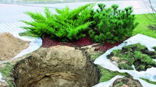
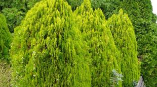
The soil cover is dominated by red-yellow and red ferralitic soils and their mountainous varieties; the most fertile are volcanic soils. soils formed in the Sierra Madre and slithozems developed on the piedmont plain and in the north. parts of the Peten plateau. The flora and fauna of Georgia are distinguished by a very high diversity and level of endemism (13% on average). Forests cover approx. 83% of the territory. On the Peten Plateau, the coast of the Caribbean and in the lower parts of the mountain slopes, humid and variable-humid tropics prevail. forests, interrupted in places by preim. secondary savannas and xerophytic woodlands. tropical forests are rich in valuable tree species (svitaniya, tsedrela, rosewood, sapodilla, guarea, bread nuts, etc.). In the middle mountains with high 1100–2000 m (the so-called belt of fogs) broad-leaved forests of oaks, avocados, liquidambar, etc. are widespread with tree-like ferns, epiphytes, lianas, above 2700 m they are replaced by coniferous forests from dec. species of pines, firs with the participation of yew. The highest peaks are occupied by mountain meadows (similar in floristic composition to the South American paramos). Prickly bush thickets in the Motagua depression, cereal savannahs and xerophytic woodlands on the plains along the Pacific coast approx. almost completely replaced by page - x. land. The high rate of deforestation (1.7% per year) leads to increased erosion and soil degradation and threatens to reduce biological resources. diversity of the country's ecosystems.
In G. there are 150 species of mammals. Within the sparsely populated plains (the coast of the Caribbean, the Peten Plateau), anteaters (three-toed, four-toed, and pygmy), the nine-banded armadillo, the Central American tapir, deer (virgian, large mazama), peccaries, tenacious-tailed monkeys live; of predators - jaguar, puma. In the mountains, large mammals b. h. exterminated, various species of small rodents, bats, raccoons (kinkazhu, coati, etc.) have been preserved. The avifauna of Georgia is rich, numbering 670 species of birds. Lots of tropical birds with bright plumage, including quetzal (quetzal) - the national symbol of Guatemala. A wide variety of reptiles, including the Central American crocodile, numerous snakes (rattlesnakes, coral asps, etc.).
There are 73 protected natural areas in G. with a total area of 2.5 million hectares, including the biosphere reserves of the Sierra de las Minas and Maya (within the national park Tikal, included in the list world heritage).
Population
58.6% of us. G. are Hispanic Guatemalans, including 57.8% - mestizos (Ladino), 0.8% - "whites" (Creoles). Indians in the main belong to the Mayan group (35.9%): quiche (14.2%), mame (5.5%), kakchikeli (4.8%), quekchi (3.9%), pokom (1.4%) , kanhobali (1.2%), khakalteki (1.1%), tsutukhili (0.9%), ishili (0.7%), chukhi (0.5%), chorti (0.4%), etc. .; a special group of the mestizo population is made up of the Garifon (0.2%). Of the non-aboriginal population, Americans live in G. (2.8%), West Indian blacks(2.1%), Chinese (0.2%), immigrants from the UK (0.1%), etc.
The population of Georgia is constantly growing (8908 thousand people in 1990; 11225 thousand people in 2000; 12389 thousand people in 2004). Population growth (approx. 2.5% per year in 2000–05; 2.3% in 2006, one of the highest rates in the region) is the result of nature. dynamics. The birth rate (29.9 per 1000 inhabitants in 2006) significantly exceeds the death rate (5.2 per 1000 inhabitants); fertility rate of 3.8 children per woman. Infant. mortality is 30.9 per 1000 live births. In the age structure of the population, the share of children (under 14 years old) is 41.1% (one of the highest in the region), the population of working age (15–65 years old) is 55.5%, the elderly (over 65 years old) are 3, 4%. There are 99 men for every 100 women. Wed the age of us. 18.9 years. Wed life expectancy is 64.9 years (men - 67.6, women - 71.2 years).
Net migration -1.94 per 1000 inhabitants; main reasons for the outflow of the population - a low standard of living, unstable political. environment. Wed us density. 117 people / km 2. The most densely populated are the intermountain basins, especially around the cities of Guatemala and Quetzaltenango, as well as the Caribbean coast in the Puerto Barrios region. The lowest population density (approx. 10 people / km 2 ) is marked on north of the country, in the depot of El Peten. Gor. US. 39.9% (2005); in small towns, part of the population is employed by agricultural workers. work in the suburbs. The largest cities (thousand people, 2006): Guatemala (1010; with the nearby cities of Misco, Villa Nueva, etc. forms the largest agglomeration in Central America with a population of over 2.9 million people), Quetzaltenango (136 .3), Escuintla (109.4).
Economically active us. 4458 thousand people (2003); 37.2% of employees are employed in agriculture, forestry and fisheries, 22% in industry, 40.8% in services. Unemployment rate 7.5% (2003). OK. 1/2 us. lives in a subsistence economy; OK. 3 / 4 us. has income below the official. poverty rate (2005).
Religion
As of 2004–05, c. 80% of the population of G. are Catholics, more than 15% are Protestants dec. denominations (2004-05), an insignificant part (about 1.5%) adheres to Judaism, Hinduism and other religions. G. is characterized by the preservation of local traditions and religious syncretism.
Historical outline
The earliest monuments of human activity on the territory of Georgia (San Rafael, near Guatemala, 10-9th millennium BC) include arrowheads of the type Clovis. The most ancient monuments of mountain Georgia are short-term cave and open sites of the 8th–7th millennium BC. e.; tools - scrapers, axes, etc.
G. was part of the formation zone of the ancient Mesoamerican cultural tradition, inextricably linked with the cultivation of corn in combination with pumpkin and beans (the Okos culture on the northwest coast, etc.). In the mountainous regions of Georgia, in the 4th millennium, one of the first varieties of corn, nal-tel, was bred, which soon spread throughout Mesoamerica (the hypothesis of a center of domestication of corn in mountainous Georgia was first proposed by N. I. Va vilov). In the 2nd-1st millennium BC. e. (preclassic period) mountainous and lowland Georgia was densely populated by numerous culturally similar groups of farmers.
The formation of the Mayan civilization is connected with Georgia (the territory of Georgia covers most of its central and southern regions). In the 6th–4th centuries BC e. to the center. area appeared the first mountains. centers with monumental architecture (Nakbe, El Mirador, Tikal etc.). Their layout was typical of later Mayan cities: an articulation of independent, astronomically oriented acropolises adapted to the relief, representing a rectangular area surrounded by temple and palace buildings raised on platforms. On the Pacific coast, the cultures of El-Baul, Abah-Takalik, and others are distinguished, dating from between 300 BC and 300 BC. e. and 300 n. e. The Mayan culture reached its peak in the classical. period (300–900 AD). On the territory of Georgia, it was developed maya letter. The monuments of mountainous Georgia differ from those of the plains in their funeral rites, style of architecture, and ceramics. products. In 1523 Spanish. conquistadors under command. P. de Alvarado began the conquest of the Center. America. On its territory was created captaincy general Guatemala (1527). Colonial Center. America, whose population at the time of independence was 1227 thousand people, was a deep economic. and political the periphery of Spanish empire. The feudal lords ruled here. forms of land use (encomienda) and contracting of labor (habitaciones, repartimiento). The social structure of society was hierarchical. character. All top adm. the posts were occupied by royal officials appointed by the Supreme Council for Indian Affairs, economic. power was in the hands of a few. (less than 5% of us.) of the Creole top, and the main. part of the Ladino mestizos (10–12%) and the Indians (approx. 80%) were engaged in agricultural work. and handicraft work and did not possess any political. rights.
In Sept. 1821 under the influence of European ideas. Enlightenment and national-liberate. movement in the south. In America and Mexico, patriotic circles headed by P. Molina and J. M. Delgado proclaimed the independence of the Central Amer. colonies of Spain. In 1823 (after their short stay in the Mexican Empire A. de Iturbide) a federation was created United Provinces of Central America, in which Georgia, as the most populous (more than 600 thousand inhabitants) and economically strong part of it, played a key role. In 1824, a federal constitution was adopted that abolished slavery and feuds. privileges.
For 12 years, supporters of liberal reforms and the federal structure of the Center. America at hand. F. Morazana and M. Galvez waged a stubborn struggle against the conservatives (big landowners, colonial aristocracy, army elite, church) for the preservation of the territorial unity of the federation. Ignoring the interests of the Indians by the leaders of the liberal movement led to their isolation and, ultimately, to political. and military defeat. Using the movement of the Indian masses under the arms. J. R. Carrera, opponents of unification Center. In 1839 the Americas succeeded in securing Georgia's withdrawal from the federation and established a reactionary regime based on an alliance of latifundists, the army, and the church. The conservative governments of Carrera, who was declared president for life, and his successor, V. Serna Sandoval, slowed down the economic. reforms and pursued an anti-national foreign policy, ceding, in particular, the rights to Belize to Great Britain. They were in power until 1871, when a new liberal revolution began in Georgia, headed by representatives of the so-called. coffee bourgeoisie - M. Garcia Granados Savala and J. R. Barrios.
The government of J. R. Barrios (1873–1885) took steps to modernize the economy (railroad construction, development of telegraph communications, electrification), political. and military institutions, education system. A new constitution was proclaimed, the church was separated from the state, restrictions on the use of child labor were introduced, and a new civil law was adopted. and criminal codes. However, an attempt to reunite the Central-Amer. state-va ended in failure and the death of J. R. Barrios.
With the establishment in 1898 of the dictatorial regime of M. Kh. Bandstands of Cabrera foreign capital began to actively penetrate into Germany, primarily North-Amer., capital, which in fact completely subordinated it to the nat. economy (production of coffee, bananas and cotton). Amer. "United Fruit Company" in the 1st third of the 20th century. became the largest landowner in Georgia and practically controlled its interior. and foreign policy. An increasingly important role in Georgia was played by the military. In 1921-30, during the presidency of Generals J. M. Orellana Pinto, and then S. Chacon Gonzalez, the first trade unions arose, steps were taken to stabilize the nat. monetary system, the development of the health care system and school education.
In 1931, in the conditions of the world economic. crisis and exacerbation of internal social and economic problems in G. was established by the military. dictatorship of Gen. H. Ubico. The so-called. the law on vagrancy, which actually enslaved the Indian population, and law No. 816, which gave the latifundists the right to dispose of the property and lives of peasant laborers and tenants. The country began wide political. repression, trade unions were dissolved and opposition banned. political organizations.
In June 1944, as a result of mass protests by students, workers and representatives of cf. layers, the dictatorial regime of H. Ubiko was overthrown (see. Guatemalan Revolution 1944–54). In 1945, a well-known society became president. figure J. H. Arevalo , in 1951 J. Arbenz Guzman . In G. were held democratic. reforms. In June 1954, as a result of the state. coup Árbenz Guzmán was removed from power. Colonel became president. C. Castillo Armas, who canceled the democratic. transformation government. After his assassination in July 1957, the extreme right-wing government of Gen. M. Idigoras Fuentes. Politicians have intensified in the country. repression against the democratic forces.
In con. 1960 a group of young officers - supporters of H. Arbenz Guzman organized an armament. speech under the slogan of the restoration of democracy and the implementation of social and economic. reforms. The country actually began civil. a war that lasted almost 36 years. Three leading revolutionaries org-tion - Insurrectionary. armed forces, the Partisan Army of the Poor and the Org-tion armed. people - in 1982 united within the front of Nat. revolutionary unity of Guatemala.
With the exception of citizens the government of J. S. Mendez Montenegro (1966–70), who tried, on the basis of the new Constitution adopted in 1965, to carry out limited social and economic. reforms, in power in G. to ser. 1980s were military. Dictators - Generals C. M. Arana Osorio (1970–74), C. E. Laugerud Garcia (1974–78), F. R. Lucas Garcia (1978–82), J. E. Rios Montt (1982–83) and O. W. Mejia Victores (1983–1986). During these years, the Constitution of 1965 was suspended, the Nat. Congress, the activities of leading political parties were banned, mass arrests and murders of opponents of the regime were carried out, and a large-scale drive of Indians from public lands was carried out.
Only after winning the elections and taking office as President of the Citizens. politics, ch. Christian Democratic. party M. V. Cerezo Arevalo (January 1986) in G. introduced a new Constitution and began a slow process of finding ways to achieve internal. peace. Attempts were made to limit the role of the armed forces. forces in politics. the life of the country and start a negotiation process with the rebels. In 1987, an agreement was signed between five Central-Amer. states (Pact of Esquipulas), which marked the beginning of the process of peaceful settlement and termination of civil. wars not only in Georgia, but also in Nicaragua and El Salvador.
Despite two attempts by far-right forces to produce a military coups, power in Georgia in 1991 legally passed to President J. A. Serrano Elias. During the years of his reign in G., mass violations of civil rights continued. rights. In 1992 and 1993 the government unsuccessfully tried to negotiate with representatives of the leftist rebels. In the spring of 1993, mass demonstrations took place in Germany demanding changes in the government's neoliberal policy. Serrano Elias's attempt to launch a campaign against corruption in government, congress and the armed forces. forces, pursuing populist goals, led to his violence. removal from power by the military.
In June 1993, Congress approved R. de Leon Carpio, member. Union of National center and commissioner for the protection of citizens. rights in G. temp. the president of the country. The term of office of the President and Congress was reduced from 5 to 4 years, a number of economic reforms. Min. Education for the first time in the history of Georgia was a representative of the Maya Indians S. Tai Koyoi. In 1994, agreements were signed with the leaders of the rebels. organizations on the observance of civil. rights, on the return of forcibly resettled Indians to places of permanent residence, in 1995 - an agreement on civil. the rights of the Indians. In Sept. 1995 was announced the time. ceasefire.
Nov. 1995 general elections were held in G.. A representative of the right-wing National Party was elected president. progress A. Arsu Yrigoyen(took office in Jan. 1996). 12/29/1996 in the presence of UN Secretary General B. Boutros-Ghali, the government of G. signed a peace treaty with the rebels, which put an end to the civil. war in Georgia, during which St. 200 thousand people, and 1.5 million people. turned into refugees (more than 80% of all victims were representatives of the Indian population, 93% of all acts of violence were committed by the army and right-wing paramilitary groups). The agreement began to be implemented from the beginning. 1997. St. 3 thousand partisans laid down their arms, and by Sept. In 1998, the army was reduced by a third (from 47 thousand to 31.5 thousand people). However, the political killings and repressions in G. continued: in the spring of 1998, archbishop was killed. the capital of G. H. H. Konder, in May 1999, a prominent democratic figure was shot dead. forces R. Gonzalez.
In May 1999, important changes were made to the country's Constitution, including clauses on improving the legal status of the Indian population, limiting the power of the military, and conducting judicial reform. Nov. 1999 took place the first after the end of civil. war general elections. Success was achieved by the right-wing Guatem party. Republican Front, led by J. E. Rios Montt. The candidate of this party A.A. Portillo Cabrera, who promised to protect human rights, fight poverty and honor peace agreements, in Dec. 1999 was elected president of the country. In Jan. 2004 he was replaced in this post by a representative of the center-right coalition of the Great National. alliance, ex. mayor of the capital O.H.R. Berger Perdomo. He continued the demilitarization of the country (in May-June 2004, over 10,000 servicemen were dismissed from the army). In July 2004, the government announced the start of compensation payments to political victims. violence and terror. Dec. 2004 Watch. The UN Commission for a Peaceful Settlement in Georgia announced the completion of its mission and left the country.
economy
The basis of the economy of G. - p. x-in, which specializes in the production of tropical. crops (coffee, sugarcane, bananas, cardamom, etc.). In terms of GDP - $ 62.97 billion (according to purchasing power parity; $ 5,200 per capita in 2005) - G. surpasses other countries of the Center. America. Real GDP growth 3.1% (2005). Human Development Index 0.663 (2003; 117th out of 177 countries). Economical policy is aimed at achieving macroeconomic. stabilization, restructuring of the financial sector, overcoming poverty. In 1997–99, in order to modernize the economy, the leading state-owned enterprises were privatized. sectors: the largest energy. companies "Empresa Electrica de Guatemala (EEGSA)" and "Instituto Nacional de Electrificacion (INDE)", b. h. transport infrastructure, as well as telephone, television, etc.
In the structure of GDP, the share of the service sector is growing most rapidly (58.1% in 2005), agriculture, forestry and fisheries account for 22.8%, industry - 19.1%. Foreign is developing. tourism (the second most important source of foreign exchange earnings after coffee exports), new hotels are being actively built. 1182 thousand people visited the city. in 2004 (826 thousand people in 2000; 884.2 thousand people in 2002), tourism revenues amounted to 770 million dollars (535 million dollars in 2000; 612.2 million dollars in 2002) . Main types of tourism: cognitive, health-improving, ethnographic, ecological. Ch. tourism objects: the remains and ruins of ancient Mayan cities - Tikal (in the north of the country, on the Peten plateau), Kaminaljuyu (now within the city of Guatemala), Quirigua (in the east of Guatemala), Piedras Negras, Peteshbatun (in the northwest), Coban (near the city - Lankin cave with an extensive network of underground passages), Quetzaltenango, Chichicastenango, Santa Cruz del Quiche (nearby - the ruins of the former Quiche capital - Utatlan), as well as the Totonicapan Valley (the area inhabited by the Mayan Indians; sulfur springs ; handicraft production of fabrics), a winter resort with a miner. springs in Escuintla, beaches near San José and Puerto Barrios. Main tourism centers - Guatemala, Antigua-Guatemala.
Industry
G. is a country with an underdeveloped industry. Mining provides approx. 0.6% of GDP (2005). Oil production is of the greatest importance. Despite the means. reserves, production is low (about 1.1 million tons per year, mainly in the south of the El Peten depot; the development of deposits is controlled by the Canadian company Basic Oil). Georgia exports part of its oil, but oil imports (from Mexico and Venezuela) exceed exports. Antimony ores (about 0.8 million tons per year), gold, and sulfur are mined, and ores of nickel (since 1981, the El Estor deposit), copper, zinc, lead, and chromium are mined in small volumes. Oil refineries operate near the cities of Puerto Barrios (Matias de Galvez) and Escuintla (total capacity approx. 1 million tons). Electricity production 6.9 billion kWh (2003), of which approx. 50% is accounted for by thermal power plants (mostly small, operating on fuel oil), approx. 45% at hydroelectric power stations (92% in 1990; the largest hydroelectric power station is on the Chikhoi River, with a capacity of 300 MW). Electricity consumption is low (approx. 490 kWh per capita), there are interruptions in the supply of electricity; in a number of districts, up to 85% of residents do not have the opportunity to use electricity.
One of the leading branches of the manufacturing industry is the food industry. So. some of the enterprises are small and medium-sized handicraft types, engaged in the processing of local agricultural products. raw materials and service market. Export products are produced by coffee processing plants, the production of sugar, rum, and tobacco products. Since the 1980s the textile industry is developing. At enterprises owned by Amer. firms, knitwear and garments are produced, in the main. for subsequent export to the USA (production is concentrated mainly in free trade zones in the port of Santo Tomas de Castilla and near Guatemala). There are also steel-rolling (production of galvanized steel) and tire plants, enterprises for the assembly of consumer electronics (based on imported components, including South Korean ones), production of chemical products. products, perfumes and cosmetics. and pharmaceutical. goods, paper, cement, etc. Osn. prom. the centers are Guatemala and Quetzaltenango. In zap. parts of G. have been preserved traditionally. occupations of the Indians - handicraft production of clothes, pottery, wood. jewelry.
Agriculture
The combination of large tropical plantations remains typical. crops (mainly owned by foreign companies and produce export products) with small farms that supply products for domestic. consumption. Latifundists and foreigners companies (0.2% of all farms) own approx. 3 / 4 of the cultivated land, the owners of small plots (in total, approx. 9 / 10 of the total number of farms) own approx. 15% of the land.
The main export crop is coffee (collection of 222 thousand tons of green beans in 2004). St. 80% of the collection is given by large plantations; main production areas - the Pacific slope of the highlands (about 80% of the crop) and the center. part of the highlands (approx. 15%, mainly dept. Alta Verapaz). Sugar cane (collection of 18 million tons of green mass in 2004) and bananas (about 1 million tons per year; plantations predominantly of the American companies Chiquita Brands International and Dole Food Co.) also have an important export value. with a drop in demand, banana exports declined significantly; hurricanes in 1983 and 1998 caused great damage to plantations). To the beginning 21st century the production of cotton, one of the most important commercial crops, has sharply decreased (collection of 166 thousand tons in 1985; 3 thousand tons in 2004). From con. 20th century significantly increased the production and export of cardamom (plantation area increased from 30 thousand hectares in the 1970s to 50 thousand hectares in 2005; collection - from 7.3 to 18 thousand tons), fresh fruits (total 1, 6 million tons in 2004) and vegetables (about 600 thousand tons, including Brussels sprouts, asparagus, peppers). Prem. for export grow flowers, essential cereals (lemongrass, citronella grass for the production of essential oils), tobacco, sesame. Main consumer crops - corn, potatoes, beans, rice; the areas occupied by them are gradually decreasing due to the expansion of plantations of export crops. Harvest (thousand tons, 2004): corn 1072, potatoes 283, beans 76, rice 29.3, melons 188, tomatoes 187, mangoes 187, lemons and limes 142.9, watermelons 126, oranges 106, pineapples 103, avocados ok . 100. Animal husbandry is extensive. Number of cattle approx. 1.5 million (bred mainly in the Pacific lowland and in the eastern part of the highlands), sheep 700 thousand, pigs 500 thousand (2005). Precious wood species are being harvested (balsa, backout, etc.; a total of 16.4 million m 3 in 2005), as well as chicle resin (for the production of chewing gum; since the end of the 20th century, the volume of blanks has declined sharply). On the Caribbean coast - fishing, shrimp, squid, lobster, etc. (15.6 thousand tons in 2005).
Transport
The total length of the railways is approx. 1 thousand km (2005), b. h. roads - narrow gauge. Main lines belong to the state. Ferrocarriles de Guatemala and connect the capital with the Caribbean coast. Road length approx. 14 thousand km (2005), b. including unpaved and gravel roads; asphalt pavement have approx. 4.9 thousand km. Main highways: highway along the Pacific coast ca. and the Inter-Ocean Highway (San José - Escuintla - Guatemala - Zacapa - Puerto Barrios). The Pan-American Highway (511 km) passes through G.. The importance of air transport, especially passenger air transportation, is growing. There are 528 airfields in Georgia, nine of them with the St. 1000 m Intl. airports - "La Aurora" in Guatemala, "Mundo Maya" near Flores; major airports - in Puerto Barrios, San Jose. Main air transportation is carried out by the company "Aviateca". Total cargo turnover sea. ports G. 15.76 million tons (2005). The most important sea ports: in the Caribbean (cargo turnover, million tons) - Puerto Barrios 1.95, located 8 km from it Santo Tomas de Castilla 4.34; on the Pacific ok. – San Jose 2.44, Puerto Quetzal 9.49 (4 km from San Jose). The length of oil pipelines is 480 km (2004).
International trade
The value of exports is 3.9 billion dollars, imports are 7.7 billion dollars (2005). So. part of the value of merchandise exports is the production of c. x-va (approx. 43% are coffee, sugar, bananas, cardamom, 33% - fruits, vegetables, flowers), 14% - products of the textile industry. Main buyers (% value, 2004): US 53, El Salvador 11.4, Honduras 7.1, Mexico 4.1. Imports are dominated by oil and oil products, machinery and equipment, electronic components, vehicles, plastics, chemicals. fertilizers, food and consumer products. Main suppliers (% value, 2004): USA 34, Mexico 8.1, South. Korea 6.8, China 6.6, Japan 4.4.
Armed forces
Armed. forces (VS, 2005) G. consist of the Ground Forces (27 thousand people), the Air Force (700 people), the Navy (1.5 thousand people) and the military. formations - nat. police (19 thousand people). The supreme commander in chief is the president. Direct leadership of the armed forces carries out min. defense through the commanders of the Armed Forces. In service - 10 tanks, 47 armored personnel carriers, 16 armored personnel carriers, 196 art. guns, 85 mortars, 32 anti-aircraft guns, 10 combat and 25 auxiliary aircraft. aviation, 12 combat helicopters, St. 30 patrol boats. Acquisition of the Armed Forces - on call, the term is valid. military service 30 months The training of command personnel is carried out in the main. in USA.
Healthcare. Sport
In G. per 100 thousand inhabitants. there are 90 doctors, 405 persons cf. honey. staff, 18 dentists (1999). Health expenditure is 4.8% of GDP (budget funding 47.5%, private sector 52.5%) (2002). Health care is decentralized, includes several sectors (public, private commercial and non-commercial, folk medicine), based on primary health care. The most common infections diseases - bacterial diarrhea, hepatitis A, typhoid fever, malaria (2003). Main causes of death in the adult population - infectious diseases. diseases, injuries and poisonings, diseases of the cardiovascular system, cancer (2003).
National The Olympic Committee was founded and recognized by the IOC in 1947. In 1952, sportsmen of Georgia participated in the Olympic Games for the first time, then since 1968. The most popular sports are boxing, wrestling, cycling, equestrian and sailing, light and weightlifting, swimming, shooting, fencing, football. In 2000, the futsal world championship was held in G., for the opening of which the Polideportivo Sports Palace was built in the capital for 7.5 thousand spectators. In 2001, the 7th Central Amer. games (the first were also held in G. in 1973); 564 sportsmen took part in 37 disciplines. In 2002, 60 km from the capital, the Volcano Autodrom was built (area 15 ha).
Education. Scientific and cultural institutions
Education is compulsory and free for children aged 7 to 14. However, in con. 1990s only 41% of children of the same age attended school. The education system includes a 6-year (in rural areas - 3-year) beginning. school, 5-year secondary school, prof. schools. In 2003, approx. 85% of students, secondary - approx. thirty%. G. has one of the lowest literacy rates in Lat. America - 69% (2003). The largest un-you: state. University of San Carlos (1676), private Catholic. un-you - un-t Rafael Landivar (1961), un-t Del Valle (1966), un-t Mariano Galvez (1966), un-t Francisco Marroquin (1971); conservatory (1875), Nat. plastic school. Arts (1920) - all in Guatemala. Scientific institutions: Guatem. Academy of Languages (1887), Guatem. Academy of Geography and History (1923), Academy of Medical, Physical. and natures. Sciences (1945), Academy of Mayan Languages (1959), Nat. Institute of Atomic Energy (1966), Nat. Institute of Electrification, Institute of Anthropology and History (1946), Nat. Institute of Geography, Nat. observatory (1925). General management and coordination of scientific. research is carried out by the National scientific council. and tech. Research (1967). National library in Guatemala (1879). Museums: colonial (1936), Santiago (1956), old books (1956) - all in Antigua Guatemala; National museum of contemporary lawsuit "Carlos Merida" (1934), Nat. Museum of History and Fine Arts (1935), Nat. Museum of Archeology and Ethnology (1948), Nat. natural museum. history "Jorge A. Ibarra" (1950), Nar. Arts and Crafts (1959), Museum of the History of Guatemala (1975) - all in Guatemala.
Media
State. information agency - Inforpress Centroamericana. Daily government. edition - gas. "Diario de Centroamérica" (published since 1880; 35,000 copies in 2005). 5 daily morning newspapers are published (circulation, 2005): Prensa Libre (about 25 thousand copies), Siglo Veintiuno (20 thousand), El Gráfico (30 thousand), La República ( 35 thousand), "El Periodico" (20 thousand), evening gas. "La Hora" (about 30 thousand). Weekly magazines - "Crónica" (15 thousand), "Crí tica" (about 10 thousand). Broadcasting since 1930. Total 640 registered. radio stations (2004); 22 radio stations in Guatemala, of which 5 are state-owned, including La Voz de Guatemala. Television broadcasting since 1956. 26 television stations (2004), 5 nationwide television channels (all pro-government), one of them belongs to the Ministry of Defense, 4 private channels (3, 7, 11, 13; belong to one owner).
Literature
Lit-ra G. develops in the main. in Spanish language. The pre-colonial period is represented by the legacy of the Maya-Kiche Indians (fragments of hymns, military songs, lyrics, myths). Preserved recorded in Latin approx. ser. 16th century mythological epic with historical features chronicles "Popol-Vuh" (published in 1861, Russian translation 1959); book of prophecies "Chilam-Balam"; nar. drama "Rabinal-Achi". In the 16th century B. Diaz del Castillo created the historical. chronicle "The True History of the Conquest of New Spain and Guatemala". Among others, the most significant. chroniclers of this time - F. Vasquez, F. Jimenez, as well as B. Villacañas, P. Sotomayor and M. Lobo, who participated in the creation of dictionaries and grammars of Indian languages. Poetry 17th century wore premier. religious character (P. de Lievana, J. de Mestanza, brothers F. and J. Cadena, nun J. de Maldonado y Paz). In the 18th century journalism began to develop (P. Molina, S. Bergagno), fable genres appeared (R. Garcia Goyene), opisat. poems (“Country Life in Mexico” by R. Landivara, 1781). In the 1st floor. 19th century in the literature of G. formed a romantic. direction; its largest representative is the poet J. Batres Montufar. A notable phenomenon was the work of the satirist J. A. de Irisarry. All R. 19th century costumbrism was born (collection of everyday writing essays “Pictures of Morals” by H. Milia i Vidaurre, 1865; the story “From a Bird's Eye View” by F. Lainfiesta, 1879, etc.). In con. 19th century naturalist tendencies intensified in the literature of Guinea: the novels of R. A. Salazar and E. Martinez Sobral. At the turn of the 19th-20th centuries. appeared the genre of politics. novel (M. Soto Hall); sharp satires. the pamphlets were created by R. Arevalo Martinez. In the 1st floor. 20th century the aesthetics of modernism was actively combined with elements of romanticism and avant-garde in the works of F. Herrera, S. Bragnas, and others. His novels in many ways anticipated the work of M. A. Asturias, who laid the foundations magical realism in lit-re G. A noticeable phenomenon lit. G. became the work of L. Cardoza and Aragon. Social issues were reflected in the work of most writers of the 2nd floor. 20th century: O. R. Castillo, R. Obregon Morales, C. Illescas, A. Acuña, C. Matute and others. In the 1990s. great popularity won the poetry of U. Akabala, who, referring to the nat. folklore, created poems in the Quiche language; in R. Menchu Tum's book "My name is Rigoberta Menchu" (1983), the life of Indian tribes is shown with sympathy. So. con writers. 20th century – M. R. Morales, G. A. Montenegro, H. Barnoia, A. Arias, F. Goldman.
Visual arts and architecture
On the territory of G. in the 3rd–9th centuries. Mayan lawsuit developed. In Kaminalhuyu, Quirigua, Tikal, temples were built on pyramidal or tower-shaped foundations, palaces, pyramids, steles with relief images of rulers, altars were erected. High artist. painted and figured ceramics, products made of stone, bone, shells, etc., differed in level. The traditions of the Maya culture were preserved in the Nar. artistic handicrafts of the Indians, manufacturing fabrics, decorated with transverse stripes with a complex geometric. ornaments, shawls and belts with ornaments and figures of people and animals; women's and men's huipili shirts are decorated with embroidery with a predominant red color. All clay utensils are made without the help of a potter's wheel; their painting often reproduces ancient motifs; Wicker vessels made of agave fibers and palm leaves are also common.
During the colonial period, towns arose in Georgia with a rectangular network of streets built up with squat, massive stone buildings with low walls and arcades. At home, prim. one-story, had vnutr. courtyard (patio) with a gallery on trees. pillars, a portal set aside from Ch. axis of the building, on the corner - a balcony or a turret (mirador). In the architecture of residential buildings, the influence of Arabic-Spanish is noticeable. Mudéjar style. From the 2nd floor. 18th century the facades were decorated with lush baroque stucco and carvings: Palacio de los Capitanes Generales (1549–68; rebuilt in 1763–64, architect L. Diez Navarro), City Hall (1739–43, architect D. de Porres) , University of San Carlos (1773, architect X. M. Ramirez), monastery with c. Nuestra Señora de la Merced (17th century, rebuilt in 1760) - all in Antigua Guatemala. In the 16th–18th centuries there was an original school of cult sculpture: trees. the statues were covered with metal, enamels and lacquer, creating the illusion of items made of precious metals (sculptors J. de Aguirre, C. Cataño, A. de la Paz, E. Zuniga). Polychrome ceramics were also made. statues to decorate churches. Painting also wore Ch. arr. religious character. The works of A. de Mantufar are especially famous. Since the 19th century (mainly in the capital) buildings were built in the style of classicism, from the middle. 20th century - in the spirit of modern European architecture. The small towns of G., populated in the main. Indians, built up preim. houses covered with straw and tiles, and preserve the archaic. shape. In 1920, the National school of fine arts in Guatemala, in 1963 - Local school of fine arts in Quetzaltenango. In the 2nd floor. 20th century masters came to the fore who turned to the life and history of the Indians (painters A. Galvez Suarez, U. Garavito, T. Fonseca, P. R. Gonzalez Chavahay, and others). Famous sculptors - X. Urruela, R. Galeoti Torres. The works of K. Merida, D. Vasquez Castañeda and others are close to abstractionism. In the last third of the 20th century. the influence of figurative expressionism (E. Rojas, M. A. Quiroa, R. Cabrera), primitivism is noticeable. In architecture, con. 20th century monumental forms of painting and sculpture are actively used (E. Resinos).
Music
Music roots. art-wa G. - in the pre-Columbian culture of the Maya, in the era of the New Age, experienced the Spanish. influence. The face of music the country's culture means. degree is determined by tradition. and folklore music of the Ladino, Maya, Garifon, and other peoples.
From Ser. 16th century received the development of music. European life. sample, an important part of which is Catholic music. churches. The composer and organist E. Franco (1554–1573) worked in the cathedral in Guatemala, and Spanish music was played. and netherl. composers. Among other musicians of the colonial period were E. de Leon Garrido, M. Pontaza, and the author of the popular villancicos V. Syens (2nd half of the 18th – early 19th centuries). L. F. Arias (late 19th – early 20th centuries) was the first composer to turn to local folklore. H. Castillo used Indian music. material in her instrumental compositions and operas Kiche Vinak (1925) and Nikta (1933, not completed). R. Castillo also turned to Indian themes (ballet Kaal Baba, 1951), who was educated in Paris and wrote music in an impressionistic style. An important contribution to the formation of nat. music G. cultures were introduced by: S. Lay, E. Solares (mid-20th century), J. Oreolana, J. A. Sarmientos, U. Ayestas, R. Asturias, I. de Gandarias, I. Sarmientos, P. Alvarado , A. Crespo, U. Orbaug, D. Lehnhoff (second half of the 20th century).
Cinema
The first film show was held in G. in 1896. The first feature film (Agent No. 13) was directed in 1912 by A. de la Riva. Two versions of the game f. The Master's Son was staged in 1915 and 1929 (directors A. Gerbruger and A. Palarea). In the 1930s filmed ch. arr. documentaries about religion. holidays and sports. The first sound film was Rhythm and Dance (1942, directors E. Fleishman, R. Aguirre, H. Gavarret). The first full-length feature film was The Hat (1950, directed by G. Andrew and Fleishman). 1944–54 was dominated by popular science films. All R. 1950s a film studio was built in the country. Among the films: "Vacation 1953" by M. Reishenbach (1953), "Daughter of the Caribbean" by S. Abulararach (1955), "A Crown for My Mother" (1958), "Earthquake in Guatemala" (1976) and "Candelaria" (1977) ) R. Lanusa, "The Joy of Life" (1960) and "Sundays Pass" (1967) A. Seurat. There were also films intended for workers and students. audiences: "Christmas in Guatemala" (1977, dir. L. Argueta), "Veil" (1978, dir. H. Chang). In 1968, the Guatem Development Association was established. cinema, in 1970 - University Cinematheque. At the turn of the 20th-21st centuries. The cinematography of G. is one of the most dynamically developing in the Center. America. The films Neto's Silence by L. Argueta (1994), Uraga by A. Carlos and G. Escalon (2002) and others testify to the search for an original film language.
Guatemala is a country of absolute opposites, which is rich in its history and is famous for its successful future. It is here that restless volcanoes and tropical rainforests, sandy beaches and endless coffee plantations are located.
Let's take a closer look at Guatemala: where it is located, the climatic features of Guatemala, the population of the country, what nature is here, what sights are worth seeing in Guatemala, the form of government and much more.
In contact with
Guatemala: Wikipedia
- The area of the state is almost 109 thousand square kilometers;
- The capital of Guatemala is Guatemala;
- The population is 14.7 million people;
- The official language is Spanish;
- The form of government is a presidential republic;
- Currency - quetzal;
- Religion - Catholicism.
Where is Guatemala located on the world map?
Guatemala on the world map is located in Central America. In the north, the state borders on Mexico and Belize, Honduras and El Salvador. The country is washed by two oceans:
- Quiet;
- Atlantic.
As stated earlier, The capital of Guatemala is Guatemala City. It is the largest urban agglomeration in Central America. The capital is located along the mountain ranges, located on the picturesque plateau. The capital is distinguished by typical attributes of Latin American cities:
- Bright buses;
- Chaotic markets.
These attributes perfectly emphasize the majesty of the buildings of the Mayan civilization. Previously, the capital of the state was the city of Antigua, but in 1776 it was badly damaged due to a powerful earthquake. Despite the fact that the capital of Guatemala was moved to a new location, Antigua occupies a significant place in the history of the North and as one of the main cities of the Mayan people. The former capital was built at the foot of volcanoes:
- Agua;
- Feugo;
- Akatenango.
These volcanoes tower majestically above the colonial buildings that keep the mystical and mysterious history of the Mayan people.
 Due to its geographical location, the climate in Guatemala can be called mild, but it is also worth noting that the air temperature here depends on the height above the level of the World Ocean. The local seasons are distinguished by the amount of precipitation and nighttime temperature conditions. Winter lasts from May to October, and summer from November to April. February, March, April and May are the hottest months in the exotic state. The most precipitation falls between May and October.
On the Pacific coast hot and tropical climate. The average daily temperature in May is +27 degrees. In December, the average daily air temperature reaches +23 degrees.
On the coast of the Caribbean during the day, the air warms up to +33 degrees throughout the year, and at night - up to +23 degrees. It is also worth noting that during the rainy season the air temperature remains the same. By the way, the largest amount of precipitation falls in this region of the country.
The best time to visit Guatemala is during the dry season from November to May.
Nature
 Two-thirds of the territory of the state is located on the medium-high and high mountain ranges that belong to the Cordillera system. The Cuchumatanes and Sierra Madre mountain ranges cross Guatemala from its northern territory to its southern one. There are 33 volcanoes in this area, some of which are currently inactive. Their height reaches 3800 meters. Tajumulco Volcano is the highest point in Guatemala. Its height is 4211 meters above sea level.
The western and southern parts of Guatemala are located on the Pacific Coastal Lowland, namely, on a flat plain, which is pierced by many rivers carrying crystal clear waters from mountain ranges.
The bulk of the country's population lives in the intermountain area between the Cuchumatanes and Sierra Madre ranges. Near Lake Atitlan is the largest basin. On its southeastern side is the capital of the state - the city of Guatemala. Banana plantations, crops and cocoa grow on the basins themselves. Pine and cedar forests grow on the adjacent mountain slopes.
The main attractions of Guatemala
 This country must be included in the list of countries worth visiting at least once in a lifetime. After all, it is here that the centuries-old history of the ancient Mayan tribes is combined with the promising future of their descendants. Guatemala is a beautiful place, located in Central America, which is filled with legendary buildings.
The capital of the state is an architectural eclecticism. It is here that modern glass skyscrapers rise above the ancient majestic mansions. And the wide and noisy city streets intersect with narrow streets where the local population sips strong aromatic coffee collected from the local coffee plantations.
Guatemala City is located in a picturesque area and is surrounded by volcanoes, lakes and endless plantations. All this can be seen from a bird's eye view by ordering a helicopter tour. The cost of such an excursion will average $ 900 for five passengers.
Favorite places for tourists cities of Tigal and Antigua. Travelers from all over the world come here to get to know the area, where the ancient buildings of the Mayan tribe have been preserved. On the territory of these cities there are now a large number of pyramids, palaces and temples that belonged to an ancient civilization.
Another city worth visiting in Guatemala is Quetzaltenango. It is famous for its healing hot springs and handmade souvenirs. In the city of Santa Lucia Cotzumalguapa, you can get acquainted with the history of America before its discovery by Columbus. You can ride on a luxurious snow-white yacht or on a real fishing boat by visiting Livingston, which is located in the northeast of Guatemala. There are also water excursions.
Local kitchen
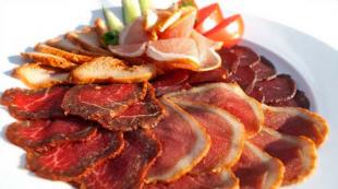
Cuisine of Guatemala very similar in its traditions to Mexican, Salvadoran and Honduran. It is impossible to ignore the Indian and Spanish culinary traditions present here, which have mixed with each other due to the rich history of the state. Most of the dishes the local population of Guatemala prepares from the following products:
- Rice;
- beans;
- maize;
- Meat (mainly chicken).
The dishes also always contain a large amount of herbs and various spices. The local population still uses Mayan recipes that have survived to this day to prepare their dishes.
Coffee is the staple drink in Guatemala., which is also a first-class export item. You can inhale the aroma of impeccable black coffee even in the most remote corners of Guatemala. Locals prefer to drink coffee not very strong, but they drink it very often - about 20 cups a day. Tea is not often drunk here. However, the most popular type of tea is Mate, which is also traditional throughout Latin America. From drinks there is a wide variety of fruit juices, as many different fruits grow in Guatemala.
Entertainment and recreation
 If we talk about entertainment in Guatemala, then here there are about 10 national parks and reserves, whose flora and fauna is very diverse. The country also has the deepest lake in all of Central America, which is called Atitlán. The descendants of the ancient Maya civilization live at the very foot of the volcano in the vicinity of this lake.
Beach lovers should visit the most popular beach in Guatemala - Monterico. It stretches along the Pacific coast and is ideal for swimming and sunbathing. By the way, it is worth noting that the beach is strewn with volcanic sand.
The country is famous for a large number of various holidays.. Each village or city has its own patron saint, whose day is celebrated, as a rule, on a grand scale, with musical performances, church services and colorful fireworks. You can get acquainted with traditional clothing and local life by visiting Sunday markets in Chichicastenango and nearby towns.
Those who prefer an active holiday with a combination of sunny beaches can find many ways to have a great time:
- Hiking in ancient places;
- Surfing;
- Mountaineering on volcanoes;
- Rafting;
- Diving and more.
What to buy?
 If you want to bring some souvenirs to your loved ones, then the best option would be products of folk art of the local population of Guatemala. It can be self-woven clothes, Indian calendars, knitwear, semi-precious stones, wooden products, ritual paraphernalia of the Mayan civilization and much more.
Such souvenir gifts, as a rule, can be bought at local markets, and the price for them can be almost halved if you bargain well. All city streets are literally strewn with various products with images of the quetzal bird, which is also the national symbol of Guatemala.
If you want to bring products as a gift, then you should pay attention for chocolate and coffee. Even the smallest store has a huge selection of these products.
All sights of Guatemala


Guatemala is the capital of Guatemala. Very easy to remember. Guatemala itself, which is a country, pleasantly surprised. The first country in Central America where I wanted to stay longer and even come back again. I'll tell you more in the coming days. And today about the capital. First of all, it is interesting because it has its own signature color - light green. All municipal property is painted green - information kiosks and curbs, buses and fire trucks, information posters and road workers' cones. Looks very unusual and stylish. And here, 5 people are killed on the streets every day - Guatemala is one of the most dangerous cities in the world.
01. Guatemala turned out to be a very cool city. It is noticeably richer than the capitals of neighboring states, there are many modern buildings, good hotels and restaurants. This, by the way, does not prevent Guatemala from being one of the most dangerous cities in the world. 
02. Slums of Guatemala. 
03. It has its own Eiffel Tower. 
04. City center. 
05.
06.
07.
08. There are many motorcyclists in the city. They often pull bags and cameras from gaping tourists. Be careful. 
09. In Guatemala, there are 90 murders for every 100,000 people. This is 41 percent of all crimes occurring in the country. Guatemala is divided into 22 regions and only 3 of them are considered relatively safe for tourists. By the way, there is an interesting sign here when someone is killed on the street, a glass of water is placed next to it - the deceased can drink from this glass before going to heaven. The police do not particularly stand on ceremony with the bandits, sometimes you have to shoot entire buses. 
10. The entrance to every decent store is guarded by a man with a gun. 
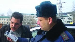
11. The military is on duty in the city center. 
12. The local police are very friendly and nice. Look at their funny hats! 
13. Not a single policeman forbade him to shoot. Just a miracle. By the way, this "miracle" reveals only 1% of murders on the streets. One of the lowest rates in the world. 
14.
15.
16. Police officers ride bicycles in dedicated bus lanes. 
17.
18. There is an unusual urban mode of transport in the city - the transmetro, along which long green buses run (2 lines, more than 20 stations). There will be a separate post about this. By the way, pay attention to the fact that everything light green is the signature color of Guatemala. Light green borders, light green police uniforms, light green buses. 
19. Light green garbage trucks. 
20. Here on such cars the police moves around the city center. All in branded colors. 
21. The municipal truck is also light green. 
22. Light green bus. 
25. Another feature of Guatemala are pillars. At the crossroads, a dozen of them can be poked. The thing is that the pillars here are private and belong to different companies. You can’t hang your wire on someone else’s pole, so everyone puts his own poles for himself. The result is a forest. 
26. Municipal pillars are green, they have a built-in tile with a coat of arms. Very touching, love the details. Each pole has a number. 
27. Everything that can be stolen is securely protected by bars. 
29. In Guatemala, it is illegal to smoke indoors. Everywhere. Countrywide. 
30. Sometimes garbage is taken out in ordinary trucks. In this case, it is collected in giant bags. 
32. The only country in the world where a zebra on the road is a zebra and not faceless stripes (actually not). 
Other reports from this trip.
Guatemala is a country of opposites: a rich history and a successful future, restless volcanoes and tropical rainforests, sandy beaches and endless coffee plantations.
This state of Central America in the north borders on Mexico and Belize, Honduras and El Salvador. Guatemala is washed by the waters of two oceans: the Pacific and the Atlantic.
The capital of the Republic - Guatemala City - is the largest urban agglomeration in Central America. It is located along mountain ranges on a picturesque plateau and has the typical attributes of Latin American cities: bright buses and chaotic markets, which emphasizes the majesty of the buildings of the Mayan civilization. Previously, Antigua was the capital of the republic, but in 1776 the city was badly damaged by an earthquake. Despite the fact that the capital was moved to its present site, called Guatemala, Antigua occupies a significant place in the history of both Americas as one of the most important cities of the Mayan people. The city was built at the foot of three volcanoes - Agua, Feugo and Acatenango, which majestically rise above the colonial buildings that keep the mystical history of the Mayan civilization.
Capital |
Guatemala |
|
Population |
14 million 700 thousand people (2011) |
|
Population density |
119 people/km² |
|
Spanish |
|
|
Religion |
Catholicism |
|
Form of government |
presidential republic |
|
Quetzal (GTQ code 320) |
|
|
Timezone |
|
|
International dialing code |
|
|
Internet domain zone |
|
|
Electricity |
American parameters, mains voltage 120 V, frequency - 60 Hz |
Climate and weather
The climate in Guatemala can be called mild, but it should be noted that the temperature depends on the height above sea level. The difference between the seasons: winter (May-October) and summer (November-April) is manifested exclusively in the amount of precipitation and temperature at night. The hottest and sunniest months are February, March, April and May. The period from May to October receives the most rainfall.
The Pacific coast of Guatemala has a hot tropical climate. The temperature during the day in May-June is about +32 °С, at night - +23 °С. During the day in December, the thermometer can reach +27 ° С.
On the coast of the Caribbean Sea, the temperature during the day throughout the year is in the range from + 31 ... + 33 ° С, at night - about + 23 ° С. During the rainy season, it remains the same high. Predominant amount of precipitation falls on this part of the republic.
The best time to visit Guatemala is during the dry season, which runs from November to May.
Nature
Two-thirds of the territory of Guatemala is located on the medium-high and high mountain ranges of the Cordillera system. Two mountain ranges - Cuchumatanes and Sierra Madre - cross the country, starting on its northern side and ending on its southern side. There are 33 volcanoes in this picturesque area, some of them are active to this day and their height reaches 3800 m. Tahumulco volcano with a height of 4211 meters is the highest point in the country.
The west and south of Guatemala are located on the Pacific coastal lowland, namely, a flat plain pierced by many rivers that carry crystal clear water from the mountain ranges.
Most of the country's population lives in the intermountain basins between the Cuchumatanes and Sierra Madre ranges. Around Lake Atitlan lies the largest of them, on the southeastern side of which is the capital of the country - the city of Guatemala. Plantations of bananas, cereals and cocoa almost entirely occupied the basins themselves, but the adjacent mountain slopes were dotted with pine and cedar forests.
Attractions
Guatemala is worth a visit to see with your own eyes how the centuries-old history of the ancient Maya tribes and the promising future of their descendants can be organically combined. This beautiful place in Central America is simply filled with legendary buildings.
The capital of the country is an architectural eclecticism: glass skyscrapers rise above the old majestic mansions, and wide and noisy city shopping streets cross narrow streets where locals drink strong aromatic coffee.
The city is located in a picturesque area surrounded by volcanoes, lakes and endless plantations, which can be seen from a bird's eye view if you take a helicopter tour, costing about $ 900 for five passengers.
The cities of Tigal and Antigua are favorite destinations for tourists from all over the world thanks to the Mayan civilization. On the territory of cities, a large number of pyramids, palaces and temples of the ancient Indians have survived to the present.
The city of Quetzaltenango is widely known for its healing hot springs and handmade souvenirs. The town of Santa Lucia-Cotzumalguapa will gladly open the pages of the history of America before its discovery by Columbus. If you have always dreamed of riding a snow-white yacht or a wooden fishing boat, then you need to visit Livingston in the northeast of Guatemala, where boat trips are held.
Nutrition
Neighboring countries - Mexico, Honduras and El Salvador - have similar traditions to Guatemala cuisine, but the latter is considered simpler and rougher. It is impossible not to notice here the influence of Indian and Spanish culinary traditions, mixed with each other due to the rich history of the country. The main ingredients of traditional dishes are maize, fried meat (mainly chicken), beans and rice. Combinations and their ratio are different, but the dishes always contain a large amount of herbs and spices. Many recipes of national dishes have been preserved since Mayan times.
Coffee is Guatemala's staple drink and a top-notch export. You can feel the aroma of good black coffee even in the most remote corners of the country - Guatemalans prefer a weak drink, but they drink it very often (up to 20 cups a day). Tea is consumed much less; among the favorite varieties, the most popular is the traditional Latin American “mate”. Fruit juices are present in great abundance, as various tropical fruits are grown in the country.
Accommodation
Hotels in Guatemala have their own "zest": original architecture. All of them are different, some can be compared with an ethnographic village, the other with a Spanish castle. But they also have something in common - excellent European-level service.
The room must be booked in advance. Resort hotels on the coast are reminiscent of hotels from the movies: fitness centers, swimming pools, playgrounds, sun loungers and palm trees.
Most hotels provide an included breakfast buffet. The staff speaks Spanish and English.
If you want to feel the full flavor of the local culture, you should stay in a “guesthouse”: full board is offered here, and the owners, for a fee, will help you explore the surroundings and tell ancient legends.
Entertainment and recreation
There are more than ten national parks and reserves in Guatemala, their flora and fauna are very diverse. Also here is the deepest lake in Central America - Atitlán. The descendants of the Mayan tribe live right at the foot of the volcanoes in the vicinity of the lake.
Monterico is the most popular beach in Guatemala, it stretches along the Pacific coast and is an ideal place for lovers of swimming and sunbathing on volcanic sand.
The country has a huge number of different festive events. Each village or city has its own patron saint, whose day is usually celebrated on a grand scale, musical performances and church services are replaced by festive processions and fireworks. Traditional Guatemalan clothing and local life can be observed when visiting Sunday markets in Chichicastenango and nearby towns.
For those who prefer active holidays to sunny sandy beaches, there are plenty of ways to spend time: hiking in ancient cities, climbing volcanoes, surfing, rafting, diving and other joys await adrenaline lovers in Guatemala.
Purchases
The best souvenirs for yourself and loved ones can be goods and products of folk art of the indigenous population of Guatemala, which include self-woven clothes and Indian calendars, knitwear, semi-precious stones, wood products, ritual attributes of the Mayan civilization and much more.
Mostly all handicrafts can be purchased in the markets of the city, where the price for them can be brought down by almost a third, after a little haggling. The streets of the country's cities are literally strewn with souvenir shops, where you can find many products with images of the quetzal bird, which is a national symbol. If we talk about products used by tourists as "gifts" for loved ones, then it must be said about chocolate and coffee, it should be noted that even a small shop can offer a large selection of them.
Transport
Urban public transport in Guatemala is a small number of old school buses from the USA. The conductor is the "main" person in such a bus, since it is his duty to report the route of movement, leaning out of the open door and shouting out the necessary information. And this happens because of the illiteracy of most of the locals. The conductor also performs the functions of turn signals and brake lights. Embarkation and disembarkation of passengers is possible even at intersections and bridges, the fare is inexpensive. It is more pleasant and much safer (however, more expensive) to travel with the help of tourist shuttles: they move between the main cities, call at the hotel and bring back. The seats there are only seated and have a good level of comfort. There is a taxi, the price for trips in it must be discussed before boarding. The only transport by which you can get to some national parks is an ordinary boat.
Connection
The Internet and cellular communications are actively developing in Guatemala. In the capital and the main tourist cities of the country, there are a huge number of Internet cafes. Wireless networks are available at the airport and several hotels. Mobile communication of the GSM 800/1900 standard is rapidly expanding. In order to make an international telephone call, you can use the services of post offices, where there are call centers.
Telephone communication within the country is carried out using pay phones, which are present in abundance on the streets of the city.
Security
In Guatemala, as in any country, there is crime, but at present, the organization of tourist safety has increased significantly. In places frequented by visitors, a fairly large number of police officers are responsible for order, but thefts by pickpockets and attacks to take foreigners' money are frequent. In this regard, you should not leave the hotels in the evening and at night, as well as walk around the city alone.
Only first aid is provided free of charge, while full medical care for foreign citizens is provided exclusively by private medical centers and its scope is provided for by the available insurance documents.
Business climate
Guatemala has a very close connection with the history of the Mayan civilization. Every year, archaeologists find new artifacts that allow us to slightly open the door to the past of this people. The authorities of the country hold specialized exhibitions and conferences dedicated to the history of the Mayan Indians, which gather not only professionals in the scientific field, but also attract a huge number of tourists.
It is important to note the significance for the country's tourism of the opening of the Ancient Mayan city of Samabah, scheduled for December 2012. Particular attention to this event is riveted because the city is located at the depth of Lake Atitlan, under the water column.
Real estate
A feature of the Guatemalan real estate market is its openness to investors. It should be noted that this direction can be called promising due to the annual increase in the number of tourists in the country. On average, the cost of one square meter varies from one to one and a half thousand dollars, although the location of the object of purchase / sale significantly affects the final price. A foreigner is presented with the opportunity to freely buy and sell real estate in Guatemala, with the exception of plots on the border of the state, river and ocean coasts.
When buying or selling real estate, foreigners must pay the prescribed taxes and adhere to the laws of the country when making a transaction. According to the law of Guatemala, a foreign person can be the owner of real estate, regardless of his migration status.
If you have decided to visit Guatemala, have already chosen a tour operator and are packing your bags with genuine trepidation, you should take a couple of minutes for tips that will allow you to enjoy your trip:
The import of foreign currency into the country is not limited, but it will need to be registered in the tax return.
You can pay for souvenirs and goods using local currency and US dollars.
Bargaining is welcomed in all markets and in all small shops, with the exception of large shopping centers.
In restaurants and cafes, tips are left - about 10% of the order amount.
To use electrical appliances, you will need adapters and adapters, since the mains voltage is 120 V.
To make an international call, use the dialing code 502 (country) and the area code (the code for Guatemala City is 2).
If you want to use your mobile phone while traveling, check if the model supports the 1800 range.
Visa Information
Beginning travelers need to know: Guatemala is part of the Common Visa Area Agreement with countries such as Honduras, Nicaragua and El Salvador. This means that if you have a visa to at least one of the listed countries, you can safely visit each of them.
On average, the period for obtaining a visa to Guatemala takes from 5 to 7 working days. The duration of stay in the country on a visa should not exceed 90 days. Otherwise, obtaining a visa occurs according to the standard scenario for processing and submitting documents to the embassy or travel agency, and, of course, the waiting time.
Embassy of Guatemala in Moscow can be found at: st. Cow Val, 7, entrance 4, office. 92. Phone: (+7 495) 238-2214.
Guatemala(Republic of Guatemala) is a country in North America. The population of this country is 14 million people. The capital is the city of the same name Guatemala (more than 1 million people). There are no other major cities in Guatemala. Guatemala has one time zone. The difference with Greenwich is minus 6 hours.
Guatemala has land borders with El Salvador, Honduras, Belize and Mexico. The country is washed by the Caribbean Sea and the Pacific Ocean. About half of the country's territory is occupied by mountains. There are many volcanoes in the country (33 volcanoes in total, 3 of them are active). Guatemala is constantly prone to earthquakes, and sometimes destructive earthquakes occur.
Almost all of Guatemala is covered with forests, they are in the country 84% of the total area of the country. Tropical vegetation prevails.
Half of the country's territory is occupied by the mountains of the Cordillera. The country also has the Sierra de los Cuchumatane, Sierra de las Minas and Maya ranges, and the low Guatemalan Highlands. The highest point in Guatemala is the volcano Tajumulco. Its height is 4220 meters.
The largest river in Guatemala is the Motagua. The largest lakes are Izabal (the largest), Amatitlan, Peten Itza, Atitlan.
Administratively, the country is divided into 22 departments: Alta Verapaz, Baha Verapaz, Chimaltenango, Chiquimula, Peten Flores, El Progreso, Quiche, Escuintla, Guatemala, Huehuetenango, Izabal, Xalapa, Jutyapa, Quetzaltenango, Retaluleu, Sacatepéquez, San Marcos, Santa Rosa, Solola, Suchitepequez, Totonicapán, Zacapa.
Map
Roads
The length of railways in Guatemala is small - 856 km. However, the country's steel lines are in good condition, with passenger trains running from the capital of Guatemala to the cities of Puerto Barrios and Santo Tomas de Castilla. In addition, the country has direct rail links with Mexico.
The length of the roads of Guatemala is 14 thousand km.
History
Guatemala was once a Spanish colony and has an interesting history.
Main periods of Guatemalan history:
a) Ancient Guatemala - the settlement of the territory of the country by the Maya Indians (1000 BC), the emergence of the first Mayan cities;
b) Medieval Guatemala - the flourishing of the Maya civilization (II-IX centuries AD), the arrival of the Toltec and Quiche tribes (X-XI centuries);
c) Guatemala - a colony of Spain (since 1523) - the beginning of colonization under the leadership of the Spanish conquistador Pedro de Alvarado (1523), the war of the Spaniards with the Quiche tribe (1524), the creation of the captaincy general of Guatemala (1564), the foundation of the capital of the country on new place after the earthquake (1776);
d) Guatemala during the struggle for independence - the entry of Guatemala into the Mexican Empire (1821), the entry into the United Provinces of Central America (1823) after the split of the Mexican Empire, the civil war (1826 - 1829), the collapse of the United Provinces of Central America (1840) and the final declaration of independence;
e) Independent Guatemala (since 1840) - the beginning of coffee production (1860), the coup d'état (1871), the beginning of the construction of railways (1880), the dictatorship of Jorge Ubico (1931), the military coup of 1944, the establishment of diplomatic relations with the USSR (1944), military coup in 1954, civil war (1957), destruction of the country's capital by a powerful earthquake (1976), military coup in 1983, new civil war (1983), Serrano dictatorship (since 1991), the end of the Serrano dictatorship (1996) and the liberalization of the political regime.
Minerals
There are few minerals in Guatemala. There are oil fields, but they are few, they do not fully satisfy the country's needs. There is no coal in Guatemala. From other minerals, tungsten, chromium, zinc, lead, nickel, and silver are mined in small quantities.
Climate
The climate of the country is tropical. There are no frosts in the country, but the temperature in the winter months can drop to 3-5 degrees Celsius. During the rest of the year, the country is warm, there is no strong heat.